sci20010a

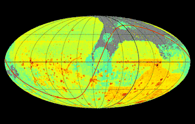
A crowd-sourced survey of the sky. The map shows the total exposure time, on a logarithmic scale, for the science images taken with DECam (566,000 images), Mosaic (241,000 images), and the 90Prime (73,000 images) cameras over the period 2004-2020.
About the Image
| Id: | sci20010a |
| Type: | Photographic |
| Release date: | May 1, 2020, 8:00 am |
| Related announcements: | sci20060 |
| Size: | 400 x 254 px |